Get update alerts
Locations
- .All Trips
- Art
- Car Culture
- Central America/Caribbean
- Food
- Food Tour
- Pic of the Week
- Sl;ovenia
.All Trips / Chile / South America
 A Storm at Cape Horn")
It would have been nice to walk on this remote island, the most southern point of South America. It was discovered by the Dutch in 1616 and is known as the “End of the Earth”. Cape Horn has a sheer 425-meter (1,394-foot) high rocky promontory which overlooks …
Exploring the Fjords of Patagonia: 6) A Storm at Cape Horn
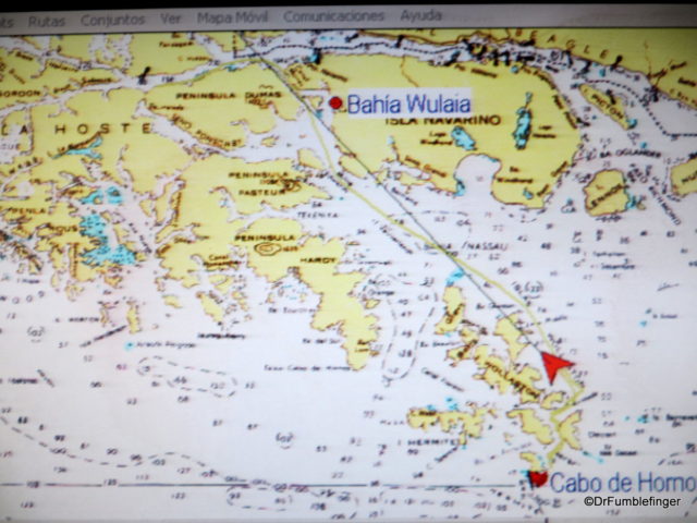
We headed south across Nassau Bay on the morning of our last full day aboard the Australis. Our hope was to be able to go ashore at Cape Horn (Cabo de Hornos), the most southerly island in the Tierra del Fuego archipelago — weather and conditions allowing. When I enquired about what our odds of going ashore were the night before, I was told 50-50. I think, in retrospect, that was an overly optimistic prediction.
Route Map, Cape Horn
It would have been nice to walk on this remote island, the most southern point of South America. It was discovered by the Dutch in 1616 and is known as the “End of the Earth”. Cape Horn has a sheer 425-meter (1,394-foot) high rocky promontory which overlooks …