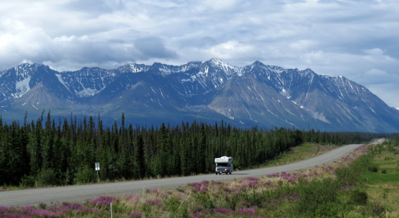
One of the greatest construction achievements of the 20th century was the building of the Alaska Highway (a.k.a. the Alaska-Canadian or ALCAN highway).
After the Japanese attacked Pearl Harbor in 1941 and showed growing interest in the Alaskan coast, the US government made construction of a road leading from the lower 48 states into Alaska a top priority. Up to that point in time, the most common route of entry to Alaska was by boat, which was considered threatened by Japanese submarines (a threat which in reality did not materialize).
The Alaska Highway begins in Dawson Creek, British Columbia, and ends in Delta Junction, Alaska, passing through Whitehorse in the Yukon territory. The route, when constructed, was 1700 miles (2700 km long). It was built very quickly, begun in spring of 1942 and completed that same fall.
The highway was opened to the public in 1948 and for a long time was considered a rough and very difficult driving route. Now it is easy, being widened and paved its entire length. The route did much to open northwestern Canada and Alaska to tourism.
This year I drove the section of the Alaska Highway from Whitehorse to Haines Junction. It’s a scenic drive, as you can see from these photos, especially as one approaches Kluane National Park. I found the road to be of good quality and hope one day to drive The ALCAN from start to finish. A good thing to do when one is retired.
(Click on thumbnails to enlarge, right arrow to advance slideshow)